Day 9: McKinleyville, CA to Burnt Ranch, CA
September 11th, 201258 mi / time / mph avg. / 6000 ft. climbing (estimated) 9p
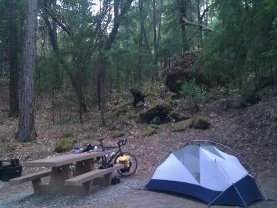
Staying at Burnt Ranch National Forest Campground
Last night I bequeathed my cyclometer to the sea. That’s the fancy electronic gizmo that shows me not only my speed and distance, but also altitude, current grade, and even temperature. When I arrived in camp, I removed it from its handlebar mount and put it in the outside pocket of my handlebar bag as I often do. That was the last time I saw it. It must have fallen out when I walked to the beach with my bag strapped around my shoulder. I retraced my steps, but given that there was at least a quarter mile of sand between the campground and the water’s edge, my chances of spotting it were one in a million. I prefer to believe that it leaped out when I crouched down to put my hand in an incoming wave: “I know where you’re headed from here, and there’s no way I’m gonna measure all that elevation for you! I’m going to end my days right here at 0 ft. while I have the chance.” It sucks because I really liked that cyclometer. Rather than waiting for a bike shop to open in nearby Arcata (and putting 8 more miles in my day), I figured I could survive without it for a couple of days and then hopefully find a similar one in the metropolis of Redding.
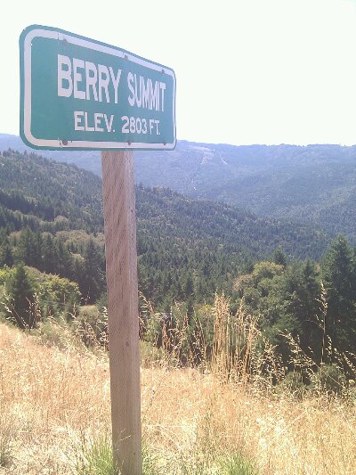
Anyway, I didn’t need my cyclometer to tell me I’d be doing a lot of climbing today. The main event would be two back-to-back hills of nearly 2000 feet apiece, topping me out over 2800 feet above the level of the sea I was just leaving. After the entirely clear day yesterday, today was back to normal, breaking cloudy and cool. I did a McDonald’s breakfast (because I knew they’d have WiFi), and then was on my way into the mountains on CA 299. I didn’t have to go many miles east before I reached the edge of the clouds bank and entered full sun.
Halfway up hill #1, a guy pulled over and asked if I knew about Chizim Road, the original route traversing the gorge between the two mountains, that supposedly is shorter and doesn’t drop you as low. I’m usually skeptical of advice from motorists, but this guy seemed to know what he was talking about, so what the heck. It turned out to be a narrow, tree-covered road devoid of traffic, diving sharply down and then back up at grades steeper than the main highway. I was on the thing for an hour (including a long snack break), and saw not a single car in either direction. What I did see was a bit of Kentucky in California. One of the handful of remote, isolated properties deep in the hollow announced itself with a line of 80s-vintage pickup trucks in various states of disrepair, simply left on the road’s edge. A fenced, muddy cliffside must have been the goat pen (before they ate the goat), and there was a peacock wandering around. Of course there were also loose dogs, but luckily none took off after me. I don’t know if it saved me anything over the main route, but it sure was different.
After finally crawling to the top of hill #2, I had a glorious descent. Apparently a logging truck was behind me actually obeying the reduced speed limit, so he blocked any other traffic from catching me and left it all mine for the 3 miles of 7%. Only a couple of times in my life have I had the honor of an electronic speed monitor informing me that I’m exceeding the speed limit on my bicycle, and until now, it had certainly not happened with a 35mph limit. Yeah! Breakin’ the law! (speaking of, in California the signs inform me the ticket for speeding is $142. For littering? $1000)
Willow Creek is the town at the bottom of the second hill, ending the run of 34 miles and 4000 feet of climbing with no services (this time there was a sign alerting you, about the distance, at least). You might think the town would be filled with non-denominational Christian suburbanites, but no, instead it’s filled with dirty brown hippy backpackers/vagrants/hitchhikers lounging about with their guitars and their matted hair and their drugs. Culture is a funny thing. Measured objectively, when I’m touring I’m probably 90% of the way there to these guys, but somehow that last 10% is critically important to me, and I intend to cling to it with all my might to keep from being identified as one of them. To help cling, I got myself an Eel River IPA with my burger lunch.
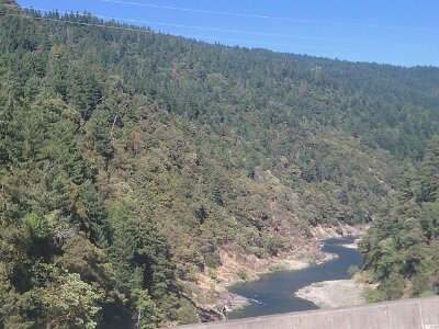
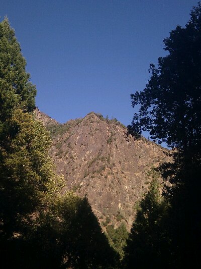
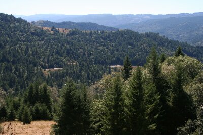
I’m now in the Trinity River Valley, which, if the climbs and descents didn’t clue you in, is incredibly rugged country. A roadside sign told me that in the 1800s it took some white guy 100 days to make it from this valley to the coast. Native Americans were far more badass and could do it in 8, and now with the road and the automobile, it can be done in 2 hours. It took me about 6, which still ain’t bad. Thanks, CA 299. There are layers of mountains in every direction, sliced by deep river valleys, and though the overall elevations aren’t too high (leaving all but the steepest peaks covered in forest), the visible relief is huge. The theme of the California section of this trip was going to be Big Trees and Big Mountains, and I’ve already covered that in the first few days.
The National Forest Campground is nearly empty, and almost seems closed, with no host, old registration tags on posts from 10 days ago, and worst of all, all the water shut off. Guess that’s why it’s $6. Today I started filling my 3rd water bottle for the first time, so I’ll survive, but it meant dinner was half a loaf of raisin bread with cheese rather than macaroni with cheese. On the plus side, I actually found time to lube up my creaking bike and put on the new brake pads I bought back in Brookings. Need to get an early start tomorrow because it won’t be a whole lot (if any) easier!
September 11th, 2012 at 4:47 pm
Looks very crinkly on the topo maps!
September 12th, 2012 at 12:04 am
found the car but had to zoom in, I confess. Thanks again for the details, thoroughly enjoyed reading the blog. The willow creek portion is my favorite from this one, especially the 10% delta you speak of :). Look forward to touring more of California through your eyes!
September 12th, 2012 at 11:39 pm
The Willow Creekers here are upset by their representation there. 😉 Such a bummer about your cyclometer! You’re being way more sporting than I would’ve been! I used to jokingly identify myself as a hippie – maybe not anymore! And yes, you’re not. 😀